
The Bonadiman Team
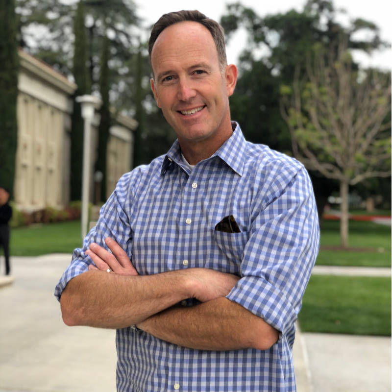
Edward J. Bonadiman, MBA, PLS

J.T. Stanton, P.E.

Michael J. Bonadiman
Ed Bonadiman has been working in the Land Surveying field for over
20 years. He has provided land surveying services with Real-Time
Kinematic G.P.S. equipment since 1994. His understanding of the latest
equipment, features, benefits, and limitations has made Mr. Bonadiman a
valuable asset on any project. Mr. Bonadiman has worked extensively
throughout the western United States and is currently preparing and staking
improvement plans, record of surveys, parcel maps, tract maps, large-area
vertical/horizontal control plats, and construction staking from our office in
San Bernardino.
He is a Past President and Corporate Member of the California Land Surveyors
Association (San Bernardino/Riverside Chapter).
Education
California State University San Bernardino, B.A. Business Administration/Management
Registrations
California Licensed Land Surveyor, No. L-7529, 1999
Arizona Registered Land
Affiliations
Past-President, California Land Surveyors Association, San Bernardino/Riverside Chapter
Land Surveyors Association
Experience
27 Years
Professional Surveying Consultant
EDWARD J. BONADIMAN, P.L.S.
234 North Arrowhead Avenue (909) 885-3806X132 Fax (909) 381-1721
San Bernardino, CA 92408 ejb@bonadiman.com
PROFESSION:
Registered Land Surveyor in the States of California (# LS 7529
General Engineering Contractor, General Building Contractor (A & B # 909172)
President of Joseph E. Bonadiman and Associates, Inc., engineering, surveying, planning
and construction management firm founded in Los Angeles, California in 1941.
EDUCATION:
California State University San Bernardino, B.A., Business Administration & Management
California State University San Bernardino, M.B.A., Master of Arts Degree in Business
Administration
Additional continuing education studies in Global Positioning Systems (GPS) and Subdivision
Map Act.
MEMBERSHIPS:
California Land Surveyors Association, San Bernardino / Riverside Chapter, Past-President
California Land Surveyors Association, State Corporate Member
CIVIC AND FRATERNAL ACTIVITIES:
San Bernardino Downtown Business Association (Member)
San Bernardino Area Chamber of Commerce (Member)
San Bernardino YMCA (Board Member)
Cub Scouts Pack 8, Redlands (Committee Chair)
Mu Kappa Tau, National Marketing Honor Society (Member)
REPRESENTATIVE PROFESSIONAL ACTIVITIES:
The following projects by Mr. Bonadiman are listed as examples to show an interested party, the various
types of experience that he has gained over his years as a land surveyor. This list emphasizes boundary
surveying and determination projects.
• Mt. Baldy Ranch, LLC Boundary Dispute (Consultant) – Worked as a consultant to determine the
location of a property line that was in dispute. Project was in an area that had little survey control,
evidence and conflicting record data. Old easements were also in dispute and were analyzed. Displays
were prepared from all analyzed data to clearly convey issues to stake holders. Hudson & Browning –
Blake Hudson, Esq.
• Klim Boundary Dispute, Redlands (Expert Witness) – Conducted a field survey to establish
boundary of project. Analyzed easements in title policy and created exhibits to clearly show property
characteristics. Deposed as expert for plaintiff. Fullerton, Lemann, Schaefer & Dominick – Wilfred
Lemann, Esq.
• Selrocco Drive, Calimesa Boundary Dispute (Consultant) – Analyzed chain of title, record of
surveys and Tract Maps along with topographic evidence in order to establish an opinion of disputed
property line position. Calculated scenarios and prepared exhibits to aid in the determination of the
property lines intended position. Gresham, Savage, Nolan & Tilden – Richard Marca, Esq.
Edward J. Bonadiman, P.L.S. 2
• Rippey Property, El Cariso, Ortega Hwy. (Consultant) – Reviewed record data and chain of title in
order to establish easement existence. Reid & Hellyer – Christopher Peterson, Esq.
• Lindsey Side Line Boundary Dispute (Consultant) – Provided filed crew to establish property line
and adjacent structures. Prepared exhibit that was utilized by council as display. Ward & Ward – William
Ward, Esq.
• Arroyo Drive, Riverside Boundary Dispute (Consultant) – Analyzed chain of title, record of
surveys and Tract Maps along with topographic evidence in order to establish an opinion of disputed
property line position. Calculated scenarios and prepared exhibits to aid in the determination of the
property lines intended position. Gresham, Savage, Nolan & Tilden – Jamie E. Wrage, Esq.
• Wal-Mart, San Jacinto, Construction Staking Issues (Consultant) – Hired by Wal-Mart to identify
the source of land surveying problems prior to and during construction activities. Analyzed data and
prepared report of findings to Wal-Mart.
• Luna Road Reclaimed Waterline (Project Manager) – Worked with the Baldy Mesa Water District
to design and specify 15,000 l.f. of 18” and 12” reclaimed water line. Scope included surveying the
alignment right-of-way, preparing easement documents and preparing plan and profile sheets for the
project.
• Patterson Boundary Dispute, Redlands (Expert Witness) – Conducted a field survey to establish
boundary of project. Analyzed property rights and created exhibits to clearly show property
characteristics. Deposed and appeared in court as expert for the defendant. Reid & Hellyer – Christopher
Peterson, Esq.
• Tract 24384 Desert Hot Springs (Project Manager) – Prepared all improvement drawings for this
396 lot foothill subdivision. Scope included working with Mission Springs Water District to provide water
and sewer service to the project.
• Crew Chief on various high-rise projects in Reno, Nevada, (Crew Chief)- 26 story Hamilton Inn
Hotel, including building alignment. El Dorado Hotel and Casino Reno
Airport Hilton Hotel and Casino. 120,000 square foot Patagonia Clothing Company warehouse, and
various other “tilt-up” type warehouses throughout Northern Nevada
• (Project Manager/Crew Chief)- Rough grade, utility, road alignment, and final grade staking on
thousands of residential lots throughout Southern California.
• L.A. to Pasadena Metro link Blue line Extension (Project Manager/Crew Chief)- Right-of-Way
acquisition and descriptions, on portions of the 26-mile project
• Cadiz Valley, California agricultural project (Manager & Crew Chief)- Utilized RTK to set vertical /
horizontal aerial control to produce contour maps and rectified orthophotos for the 2,240-acre area.
• 3,400-acre boundary survey on the Mariano Rancho in Ventura, California (Crew Chief)-
Provided Real-Time Kinematic surveying services to locate boundary monuments and the City / County
line.
• 2,800 acres residential/industrial development in Reno, Nevada (Crew Chief)- Set aerial control
with Real-Time Kinematic G.P.S. for the entire project.
• Community Sewer Improvements, Baker, California (Manager / Crew Chief)- Met with Cal-Trans
and pulled a permit to bore 460 feet under Interstate 15. Provided both preliminary control and construction
staking for boring and sewage lagoons.
• (Project Manager / Crew Chief / Cartographer)- Various A.L.T.A., Record of Surveys, Parcel Maps
and Tract maps, throughout Southern California from preliminary research, to document and legal
description evaluations and all field work.
Mr. Stanton has designed and managed many types of Civil Engineering projects and has an extensive background in surveying. He has been responsible for studies, designs, and management of public and private projects throughout Southern California.
In addition, he has worked extensively with Riverside County Waste Management providing engineering and field surveying services for the construction, expansion, and maintenance of landfill sites throughout Riverside County.
Education
California Polytechnic University, Pomona, B.S. Civil Engineering & Surveying Engineering
Registrations
California Licensed Land Surveyor, No. L-7529, 1999
Affiliations
Registered Civil Engineer California No. C-70944 New Mexico No. C-19296
Experience
11 Years
Mr. Bonadiman has over 24 years of experience in Land Surveying, Photogrammetry, and Global Positioning System (GPS) experience. As Director of Surveys for Joseph Bonadiman & Associates, Inc., he possesses a high level of Project Management expertise with extensive technical knowledge of Field Surveying (including boundary and topographic), Mapping, and staking calculations for commercial, residential, and municipal projects.
In addition, he has technical knowledge of grading plans, plan and profile, traffic control plans, topographic plans, right-of-way maps, traverse closures, parcel and tract maps, Records of Survey, legal descriptions, and plats.
Mr. Bonadiman is proficient in the use of AutoDesk Land Development Desktop (all versions), Autodesk Civil 3D (all versions), CIVILCADD®, and all industry-standard equipment, including TGO (Trimble Geomatic Office), Trimble S6 Robotic Total Station, R8 GPS Stations, and handheld data collectors.
Dennis W. Jackson , PE
Senior Water Resources Engineer
Mr. Jackson, as a Project Engineer and Hydrologist for Joseph E. Bonadiman & Associates, Inc., has gained extensive experience in hydrology, hydraulics, and drainage design engineering.
Mr. Jackson has been Project Engineer for hydrology analysis and design of drainage improvements for developments in San Bernardino, Riverside, Kern, San Diego and Los Angeles counties. These drainage designs required both the use of county hydrology manuals, U.S. Army Corps of Engineers’ programs, and the hydrology/ hydraulics programs developed by Mr. Jackson.
On a daily basis, he provides advice and instructions to many engineering firms on use of software for the design and analysis of storm drain channels, or the preparation of hydrology studies.
He is a Member of the American Society of Engineers as well as the Floodplain Management Association.
Education
California Polytechnic University, Pomona, B.S. Civil Engineering, cum laude
Registrations
Registered Civil Engineer California No. C-47434
Affiliations
American Society of Engineers Floodplain Management Association Chi Epsilon
Experience
24 Years
